Transcend space and time as you follow the not-so-newlyweds, Annie, and Miles on their timezone traversing and place-making adventures....
Where are we now?
View Where are we now? in a larger map Jo, Annie, Miles and I are living in Northport, Alabama and working at the University of Alabama in Tuscaloosa. We've been glad to be in one place for a bit after what appeared to be semi-permanently traveling (in actuality for a period of 2.5 years).We started this blog to catalogue some of the adventures when Jo and I were sequentially conducting our dissertation research in India and Brazil. While we've fallen off the blogging bandwagon somewhat during recent trips to Brazil, we're trying to pick it up again now that we're back in India!
Monday, June 28, 2010
Greetings from Ilha Grande!
So I´m back at Ilha Grande for a little writing retreat...as you can see from this picture I´m getting alot of writing done! Just kidding, it´s actually quite productive to be here.
It says alot for a place that I came here last year and spent a few days, and with all the places I haven~t been in Brazil, I came back at the first chance I got. The reasons are simple. It´s close to Rio (about 3 hours), it´s pretty cheap. And there are really endless outdoor opportunities.
Today for example, I went for a 10 mile hike/run through the rainforest around the island to the most amazing beach, location of this photo.
Which just goes to say.....please come and let´s take a trip here!
Thursday, June 24, 2010
Sunset....Rio style
If you are ever in Rio I can´t recommend highly enough going to Pao de Açucar (Sugar Loaf) for the sunset on a clear day. Absolutely magnificent (likely thanks to the pollution being trapped by the mountains, but oh well). Even more amazing than the actual sunset, which was great, was watching all the lights come on all over the city! So cool!
Their are several ways up to the top. One can take the cable car. One can climb the mountain itself, which I didn´t. Or one can take a pretty strenous hike up the backside. I chose the latter, and phewwwww I am beat. It was an incredibly tough hike, but oh so worth it....
Bingo!
Uncross your fingers (mine are still sore from last night), but it actually worked. Now I won´t really feel 100% until I have the photos in hand and correctly georeferenced within the GIS database, but I am now light years ahead of where i was yesterday at this time....absolutely unbelievable!
So I went back to the archives this morning and spent 3 hours with my new good friend Lt. Nuçez. At first he was doubtful we would be able to find the area of interest. The reason being that the scale of the indice, which is in the photo below, is 1:180,000. For those of you not too familiar with these sorts of things...that means it´s really hard to make things out on the ground. However, armed with my laptop, I was able to pinpoint the latitude/longitude of the site by placing a grid ontop of my area of interest. Before I devolve into computer geek/photogrammetry babble, let´s just say that with some basic math I was able to determine which photos comprise the area I am interested in....BINGO.
Now, unforunately, it wasn´t quite so easy as determining the photos I was interested in and pulling them from the catalog. These photos were taken in 1966 and only exist large format negative form. So what I had to do was place an order for the photos I wanted. It was very lucky that I set up two weeks for this part of the trip, because it will take them one week to develop the photos....and I leave next weekend for the Northeast (of Brazil mind you). This was not a cheap endeavor, getting 28 photos (4 flight lines at 7 photos per line) printed from negatives (this is an 8X11 reprint that overlaps correctly for photogrammetric usage/stereoscopic viewing ((geek speak decoding: think 3D Avatar, with the overlap of the photos enabling me to view the photos and conduct analyses in 3D...on photos from 1966!). But it was not too too expensive, relatively, in comparison with say the GeoEye imagery I was awarded by ASPRS, and regardless, these data are actually priceless and will be a cornerstone of my dissertation!
So, I´d like to thank all of the various people who helped me find this place, as well as those who told me it didn´t exist. Now that I know photos exist of 1966, the question is, are there other needles in this haystack i.e. maybe photos from the 70s, 80s, or 90s?
...and let´s just say that a preliminary examination of these photos via the index is pretty clear, this was not necessarily a virigin rainforest in the mid-1960s.
Wednesday, June 23, 2010
Within reach....
Fingers crossed, fingers crossed: Here goes my attempt at not jinxing mine (or Indy´s) chances at the treasure....
For those of you who don´t know, which is probably most of you, I´m here in Brazil for three reasons:
1) to work for my professor Don Nelson in the Northeast of Brazil during the month of July. I´ve been working as his research assistant for the last half-year, putting together a pretty large relational geodatabase....more on that perhaps at some point.
Working for him is great on a number of levels, but one bonus is that it ´requires´me to come to Brazil (you can probably hear my arm being twisted).
So with a job in Brazil this summer I thought I´d tack on two extra weeks on each side of the trip (hey, it´s a long trip down here and this is where my research is), so...
2) reason two is to visit my fieldsite in the southeast of the Amazonian state of Para (see below)
Visualizar My fieldsite em um mapa maior
and
3) to visit the militaries archives in Rio de Janeiro.
For those of you who have gotten lost as I´ve switched dissertation topics over time (I don´t blame you, half the time I forget...) I´m doing research on the learning and landscape change within the Brazilian Landless Workers´Movement-MST). As part of this research, I want to understand how the landscape in the southeastern Amazon has changed over time. Particularly, I´m interested in questions about histories of land use, i.e. when was the region first deforested, the early 20th century, the 1950s, 60s, 70s, 80s, 90s? You get the point....
So, to help me understand this process of landscape change I´ve become very interested in satellite photos and aerial photos (from airplanes). (Un)fortunately, while aerial photo archives in the US are easily accessbile online (dating back to the mid-1930s) in Brazil, their existence, location, and time series was a needle in a haystack-hence reason # 3 for coming to Brazil.
In an effort to make this blog post a little shorter here´s a quicker summary:
After about a year of talking with people all over the United States, and Brazil (people who alternately told me ´no these photos definitely don´t exist; maybe, these photos might exist is Rio or maybe in Manaus or maybe in Belem (the equivalent of saying you should go to either D.C., Miami, or Seattle, one of those place might have what you´re looking for...), and Yes, those photos should exist somewhere) I got back down to Brazil, and went to the military archives in Rio.
Why the Military archives? Well, for those who need a brush up on Brazilian history, the military dictaroship controlled the country from 64-84 or so and, being the military, have an airforce and hence airplanes and hence...you get the picture (couldn~t help that one). Anyways, so it turns out there are various military archives here in Rio....great. Well after three days of going around and being told No, no, no.....
BINGO! (finger´s crossed, finger´s crossed)
In a dusty old room, in a dusty old building, filled with these giant filing cabinets...I think I found my treasure.
The treasure? Photo indices. The indices document the flight plans (think of when you open a road atlas and it has a big map of the country with squares indicating on what page the map of say Georgia would be....that´s the type ofindex I´m referring to)
After talking for a while with the military officer (waiting for the inevitable ´sorry´, he said, that area, right there,...oh yeah, we got that.
Dumbfounded silence.
You mean you´ve got that here?
Oh yeah. Right here...
and he goes and pulls out a sheath of yellowed photo indices from the 1960s.
The only stumbling block (for one not so well trained as ole Indy here) is that you can imagine that photos taken at 30,000 feet over the Amazon (think many many rivers) might be hard to seperate....that´s where past research and my laptop come in handy. Tomorrow morning I will be spending some quality time with Major Nuçez and the GIS database I have on the Amazon, looking at the lat/long coordinates on the various photos and determining where my field site is and what years of photos exist.....
Now how was it that Indy got that golden statue out of the temple....(that´s a post for tomorrow...but I have a few tricks up my sleeve)
Sunday, June 20, 2010
Ruminations on what´s important
Above is a photo taken today at a really nice Sunday afternoon family gathering here in Rio. Pictured left to right include Renardo, Leonardo, Cleaine, Antonio, Carla, little Manuela, and me (Please excuse any mispellings). Today´s gathering was ostensibly to watch the world cup game, but yesterday there was a similar gathering, and I get the feeling these are very frequent events as the whole family lives within a few blocks of each other.
Relaxing after the family had left yesterday, Antonio (the father) and I were talking about where my family lives. `How long does it take to get to see them´he asked; well, five hours by plane for my brother,12 hours by car for my parents and in-laws and so on. ´Caramba!´he said. We had a very interesting discussion about cultural differences between Brazilians and Americans, and why for Americans it seems somewhat natural to move to be where you want to be (whether that´s for a job, environment, friends, or family). Antonio thought this was all very strange and wondered why we move so far away from each other....
I wonder as well.
(of course living a few hours apart is one thing we can probably attribute to national culture, our conversation didn´t touch on why we´d each be crazy enough to live in Delhi or Brazil for a year...)
Top of the world!
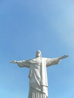
In reality, it´s probably only several thousand feet up, but when one visit the Christ the Redeemer statue atop Corcovado it seems like you really are at the top of the world. Seeing the statue was neat (upclose, as one can see the statue from throughout Rio, including from the terrace of this apartment). However, for me it was the sweeping view of the city, the surrounding mountains, and the ocean that was truly aweinspiring.
Saturday, June 19, 2010
Bemvindo a Rio de Janeiro
Rio is an incredibly beautiful city, surrounded by mountains and incredible beaches. No wonder the cariocas are so proud of their locale! I´m having a wonderful time with Antonio, and Cleiane, whom are friends of my Uncle George and Aunt Jean from their time living in Rio. Ok, back to futebol! It its the world cup after all.....
Monday, June 14, 2010
It's official!
The Meek men are all hitched! We had an absolutely phenomenal time in NV!
Many thanks to Jon & Gita as well as the Gelfers for hosting the beautiful wedding, Rachel for her unbelievable efforts in organizing, my parents for a wonderful rehearsal evening, Marina and Isaac for local hospitality, all of Jon and Gita's friends and relatives for their well-wishes and support. It was not only a great day and a perfect wedding, but a great week leading up to the wedding. Here are a few photos from Las Vegas (sorry, as per custom, no photos of the bachelor/ette parties, or of "Judy"-you'll have to ask me on that latter one!) Many thanks to Gail Weaver and George Meek for the beautiful photos!
Dave learns to quilt (!) at the hands of the onlooking master, Gail Weaver.
Gita's gaggle of girlies were out in numbers and put us men to shame!
Dave and Dave enjoy a breather on a rigorous hike the day of the wedding.
The beautiful couple
Gita brought tears to many people's eyes (including my own) as her parents, Alex and Frida, made their entrance
The handsome proud parents dressed up in post-RV finery
One sweet kiss!
Gita dances the hora as supported by many, including Josh Kaplan.
Friday, June 4, 2010
Thursday, June 3, 2010
Wednesday, June 2, 2010
Exploring the Rockies at Rocky Mountain NP
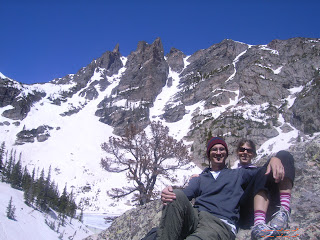
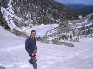
Below are some photos from a hike Jo and I took in Rocky Mountain National Park. As you can see it was gorgeous, albeit very snowy! Let's just say we weren't quite so prepared in our sneakers, but oh well, we had a great time getting high up above the crowds. The photo that doesn't look like it has anything in it, is actually a photo of Jo as a small dot across the valley, the photo of her with her arms flailing is her running (glissading) down the mountain...more photos to come!
Subscribe to:
Posts (Atom)